The Bronte Trail – Haworth to Hardcastle Crags
BD22 0ER
Distance: 26.67km
Elevation: 728ft
Description
Why not venture a little beyond the Leeds to the quaint village of Haworth, the beautiful home of the Brontes. Famous for being the backdrop of Wuthering Heights, the Railway Children and the Tour de Yorkshire. There is certainly plenty to explore here if you are not too tired post-run!
The route is a challenging one – mostly trail and off road, covering approximately 16.5 miles, (if you wanted to make it a couple of miles longer, then park in Haworth – the Bronte Museum carpark). This run has stunning views throughout, and pick the right time of year, and this moorland landscape is an expanse of purple heather.
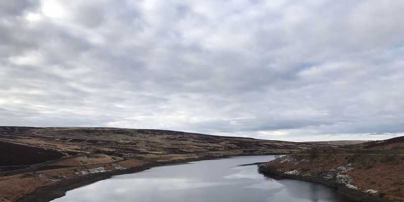
This (almost) circular route certainly has plenty of photo opportunities, including the Bronte Waterfall, Top Withens, Widdop and Gorple Reservoirs, and Hardcastle Crags as you head towards Hebden Bridge.
The route also covers sections of many ramblers favourites, including The Bronte Way, The Calder Aire Link, The Pennine Way, and those of you familiar with the Grim Up North Races – it follows some of the Wuthering Heights Wander Race Route.
The start point of the run, and the place for free parking, is on cemetery road. If you continue to follow this road, you will eventually come to a junction where you need to cross over Moorside Lane/Reservoir Road and follow the signs for the Bronte waterfall. This stony track through farm and moorland will take you to the lovely Bronte waterfall, where you cross over the small stone bridge and head up the steep hill, turning left at the top of the hill and following the signs for Top Withens.
This narrow track through Haworth moorland will cross a lovely stream before heading up the hill towards the dramatic location of Top Withens, a ruined farmhouse and a single tree, which is said to have been the inspiration for Wuthering Heights the novel by Emily Brontë. The ruin lies on the Pennine Way and is the attraction of Japanese literary tourists, which is why some of the footpath signs in the area include directions in Japanese.
Pass by the ruins and follow the stone slab path upwards. Once you reach the brow you will be treated to a stunning view of the valley and the numerous reservoirs below. It is a pretty exposed area, so make sure you pick decent weather and low winds if at all possible!
Head down the hill and turn right at the bottom following a track, which will take you around Walshaw Dean Middle Reservoir (one of many beautiful reservoirs on this route). If you loop around Walshaw the track eventually becomes quite a smooth narrow road, clearly signposted as the Pennine Way. Stay on the Pennine Way, which will eventually bring you alongside another reservoir – Gorple Lower.
Keep following the track with a water ditch running alongside it, until you reach Widdop Road. Cross over this road and follow the wooden sign that leads you into the National Trust maintained – Hardcastle Crags. Follow the very steep steps down into the forest and Harden Beck running along the bottom. You will need to turn right at the bottom and follow the river’s undulating path until you reach a bridge to take you back across and start your upward journey back up the valley.
The steep climb back will take you past an impressive waterfall, through some pretty farm houses and lodges of Walshaw, and up past the signs for Horrowdiddle. Keep going up straight, heading back towards the first reservoir – Walshaw Dean Middle Reservoir. This time the track follows the other side, and will eventually bring you to a metal gate, which you will need to cross and back to the bottom of the steep hill you came down previously. Retrace your steps here, returning to the stone slab path that takes you back to Top Witherns.
Pass the ruins once more, but instead of taking the downhill grassy slope that you climbed up from Bronte Falls (oh those many miles ago!), but instead keep following the stone slab path heading towards Stanbury. This turns into a lovely sandy trail heading downwards, keep following the signage to Stanbury as the track goes over a cattle grid and becomes a narrow road called Back Lane. This will meet with a rather bigger road, turn right and along the Main Street through Stanbury. Going past the village school, pubs and picturesque playground. Follow the road out of Stanbury, but instead of continuing straight along Sun Lane back to Haworth, turn right and downhill along Reservoir Road, taking care of the occasional traffic as the pavement is very narrow.
Come off Reservoir road onto a track on the left, which will bring you steadily back uphill to the carpark and the start point – with a handy viewing point bench at the top, for you to take well earned rest!
Facilities
There are plenty of cafes and pubs in Haworth village. There are also public toilets in the Bronte Museum Car Park (although). Just over the mid-way point as you enter Hardcastle Crags, there is a toilet and cafe at Gibson Mill if you run a little further before turning back.
Arriving by public transport
The closest train station from Leeds is Keighley, on the Skipton line – from here you can catch the Steam Train (quite an experience, but not very frequent if it is not the weekend) or the bus to Haworth village.
Arriving by car
There is a small number of free parking spaces along Cemetery road where the start point of the route is on the map.
There are also carparks in Haworth village.