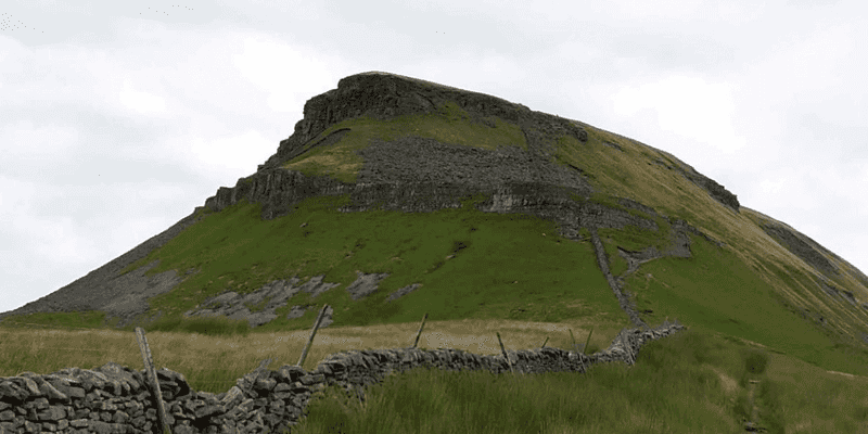
Helwith Bridge to Pen-y-ghent and back!
BD24 0EH
Distance: 16.09km
Elevation: 519ft
Description
Run, hike, (or a combination of both). This challenging, yet beautiful, 10 mile circular trail.
This route includes one of the famous Yorkshire Three Peaks, Pen-y-ghent. But also some flatter, more gentle miles following the River Ribble. It is an excellent introduction for anyone wanting to try fell running, a challenging hike, or training to do the full Three Peak Challenge.
From the starting point of the route at Helwith Bridge, you will need to take care following the Austwick road over the bridge (and the River Ribble), where there is a junction where you need to cross the main road – B6479. Almost directly opposite this junction, on the other side of the B6497, you will see a stony track heading upwards, signposted with a wooden sign to Moor Head. This is the track you will need to follow steadily upwards, which will eventually bring you to the bottom of Pen-y-ghent.
If it is a clear day, you should be able to see this peak as you approach. There is a fork in this track early on, but ignore the signpost for Moor Head, as you keep left and continue on Long Lane. There is another fork on this track, continue onto the Pennine Way, and keep heading upwards towards Pen-y-ghent, which should be a pretty obvious at this point, and a pretty impressive sight it is from this vantage.
You will be joining the ‘official’ Yorkshire Three Peaks route once you reach the base of the peak. Follow the stone steps for this steep ascent. There is a bit of a scramble, before you reach the final climb to the summit.
Once at the top, take the path downwards, which continues to follow the Pennine Way all the way to the bottom. As you can see on the map, we decided to take a short detour taking a path to the right, to visit the impressive Hull Pot.
It is quite a sudden and pretty steep drop though, so take care if you have dogs or children with you!
Once the detour is over, re-join the Pennine Way path, which is through the wooden gate and signposted for Horton-in -Ribblesdale. The other path, which looks like small stone steps heading upwards is the official Yorkshire Three Peaks path, and will take you to High Birkwith, and peak number two – Whernside.
Perhaps save this for another day!
As you follow the stony track back down to the village of Horton, you will eventually meet with B6479. Opposite this is the (now closed) Pen-y-ghent cafe. Instead there is now a small shop on your left (which as you can see on the map we decided to try out for a brief pit stop!). You need to be heading right along this brief part of road (B6479), where you will cross through the main carpark for Horton village and the public toilets.
(If you have taken the train to Horton-in-Ribblesdale this is your start point!)
There is a wooden footbridge that crosses the River Ribble (but not the road) just next the car park, keep an eye out for a small wooden swing gate at the foot of the bridge which takes you into the green field next to the river (and under the bridge). There is a path here that follows the river out of Horton and a few miles of flat, passing by a few campsites and farms. There is a signpost for Helwith Bridge to look out for near a lovely wooden footbridge – also a good place to cool off your feet on a hot day.
Eventually you part ways with the River Ribble, having passed through a farm. You will then be taking the signposted track through a number of fields and various stiles until you reach a bridge that takes you underneath the railway line. Here you can join the small road (mostly used by quarry traffic only) or the path that runs alongside it for the last short section, which brings you back to Helwith Bridge and your end point.
Facilities
There is the Helwith Bridge pub if you using this as your start and end point, as well as a a couple of pubs in Horton-in-Ribblesdale; The Crown and The Golden Lion.
Horton also has a small shop which sells snacks, sandwiches, hot drinks and ice-creams.
Public toilets are also located by the Horton village carpark (this is directly on the route).
Arriving by Public Transport
The closest train station is the Horton-in-Ribblesdale stop. There is a direct train from Leeds, which is part of the Leeds – Settle – Carlisle route. For train times see here.
If you are arriving by train, you can easily alter your start and finish place, as the route map in Horton passes very close to the station.
Arriving by Car
If you put the postcode for the Helwith Bridge Pub into satnav, you will see there is a free carpark directly opposite (there is a height restricted entrance though, so if you are in a camper van you may want to park in the pub carpark).